
 Imagen sugerida
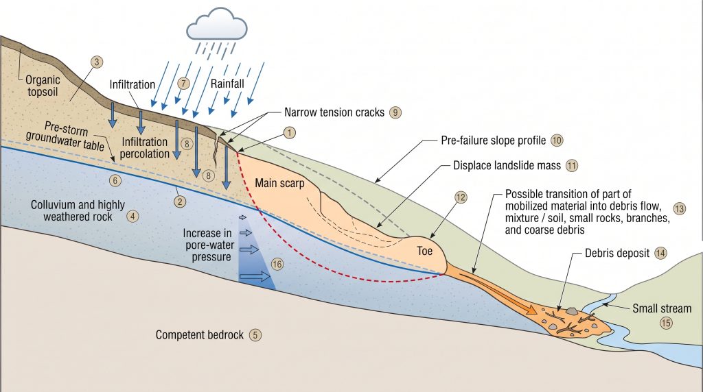
Prompt IA: AI image prompt: Technical illustration showing a hydrological and geotechnical cross-section of a mountain slope. The diagram displays rainfall infiltration arrows, subsurface pore-pressure zones highlighted in blue gradient, a failure plane in red, and run-out path with debris flow deposit in orange. Clean, professional engineering diagram style on white background with labeled elements.
Alt text: Technical cross-section diagram of landslide triggering mechanisms including hydrological pore pressure analysis for mountain risk studies
Phase 3 — Hazard Zonation and Run-Out Modeling
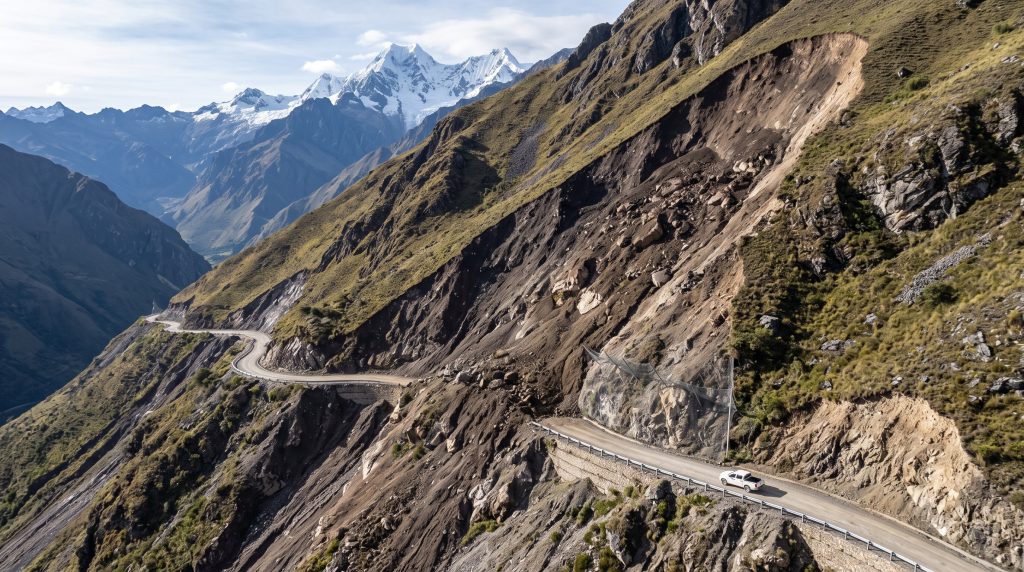
Not all slopes within a project area carry equal risk. Hazard zonation maps classify terrain by susceptibility and hazard intensity, distinguishing between source zones (initiation areas), transport corridors, and deposition fans. For debris flows — one of the most common and destructive mass movement types in mountain terrain — dynamic run-out modeling simulates flow velocity, depth, and lateral spreading, allowing engineers to define defensible buffer distances and design loads for protective structures.
Run-out analysis is inherently hydraulic in nature: debris flows behave as dense, non-Newtonian fluids obeying continuity and momentum equations. Our team applies specialized simulation tools (including depth-averaged shallow-water equation models adapted for sediment-laden flows) to produce spatially explicit hazard intensity maps at multiple return periods.
Phase 4 — Vulnerability, Exposure, and Risk Quantification
Hazard alone does not constitute risk. Risk emerges from the intersection of hazard intensity with exposed assets and their vulnerability. For an industrial facility or a linear infrastructure corridor (roads, pipelines, transmission lines), the risk study must quantify:
- The probability of a damaging event occurring within the design life of the asset
- The structural vulnerability of each asset type to the expected flow depths and impact pressures
- The expected economic losses and, where required, life-safety metrics
Quantified risk outputs enable project teams to prioritize mitigation investments rationally — a critical requirement when budgets must be defended to executive decision-makers and financing institutions.
Engineering Mitigation: Structural and Non-Structural Measures
A complete risk study does not stop at characterizing the problem — it identifies and evaluates risk-reduction options. Mitigation strategies for mountain landslide hazards fall into two broad categories:
- Structural measures: Check dams and debris basins to trap mobilized material; flexible barrier systems (rockfall nets, debris flow barriers) engineered to specific design loads derived from run-out modeling; slope drainage systems to reduce pore pressures; retaining structures and soil nails to reinforce marginally stable slopes.
- Non-structural measures: Early warning systems integrating rainfall thresholds with automated sensor networks; land use restrictions within mapped hazard zones; maintenance protocols for drainage infrastructure; emergency response planning.
The selection and sizing of structural measures depends directly on the hydrological analysis: a debris basin designed for the 100-year debris flow peak discharge requires the same probabilistic hydrology inputs as any flood control structure. This is why integrated hydrological-geotechnical expertise — rather than purely geotechnical analysis in isolation — produces more defensible and cost-effective designs. Our engineering consultancy for flood management provides this integrated capability across mountain and piedmont terrain.
For clients developing infrastructure in steep catchments, it is also worth noting the overlap between landslide risk and alluvial fan flood hazard. Debris flows that initiate on mountain slopes frequently transition to hyperconcentrated floods as they reach lower-gradient fan surfaces — a process that our flood risk analysis framework explicitly addresses. Similarly, the hydrological studies underpinning landslide triggering thresholds draw on the same methodological foundations described in the importance of hydrological and hydraulic studies in flood prevention.
Imagen sugeridaPrompt IA: AI image prompt: Aerial drone photograph of a concrete and steel flexible debris flow barrier installed in a steep mountain torrent channel. The structure shows clear engineering design with cables, posts, and retained debris material. Surrounding terrain is rugged mountain forest. Photorealistic, professional infrastructure photography style.
Alt text: Debris flow barrier structure in mountain torrent channel as mitigation measure identified in landslide risk study
Regulatory Context and Deliverable Standards
Risk studies for mountain terrain must satisfy increasingly stringent regulatory requirements. Environmental impact assessment frameworks in most Latin American jurisdictions now explicitly require mass movement hazard analysis for projects located in or adjacent to steep terrain. Infrastructure financing institutions — including multilateral development banks — maintain their own technical standards for quantitative risk assessment that often exceed national regulatory minima.
EHMH Group prepares deliverables structured to meet these requirements: georeferenced hazard and risk maps in GIS formats compatible with regulatory submission systems; uncertainty documentation consistent with probabilistic risk frameworks; and technical reports written to communicate complex findings clearly to multidisciplinary review panels. Our broader portfolio of hydrological and hydraulic engineering services ensures that landslide risk studies are produced within a coherent technical framework — not as isolated assessments disconnected from hydraulic design and watershed management.
Partner with EHMH Group for Mountain Terrain Risk Studies
If your organization is developing, operating, or permitting infrastructure in mountainous terrain, a well-executed estudio de riesgo de desmoronamientos en zonas de montaña is one of the most high-value technical investments you can make. It reduces permitting risk, informs insurance valuations, protects physical assets, and demonstrates due diligence to regulators and stakeholders.
EHMH Group combines specialized hydrological modeling expertise with geohazard risk assessment to deliver studies that are technically rigorous, regulatory-ready, and actionable for engineering design. Contact our team today to discuss your project requirements and learn how we can support your mountain terrain risk assessment needs.